
18 September 2025
A freshly made cappuccino in a ceramic cup in the middle of forested mountains, above a rushing river, at 5856 feet above sea level. What’s not to love?

Today is our third full day of a 6-week trip. First stop, Samedan, Switzerland, which will have many of you powering up Google Maps to figure out where-in-Hell are they now?
Jet lag is still present, but the fog is clearing by the day. Flatlander legs (Forest Grove is at 210 feet and flat as a crepe) are adjusting to hills and sea level lungs are slowly adapting to mile-plus-high altitude. We are sleeping at 5650 feet!
But first an aside: you are likely wondering where I have been since my April 27 post about a trip we were about to take. For reasons I will not go into, that trip never happened. Rest assured, all is well at Casa Barton. Last spring’s trip will be a 2026 event.
Our trips largely consist of meals strung together by long walks. We call them “Paths to Lunch.” Today it was a path to cappuccino with a lunch at trail’s end. Try to do that in the United States.
The hike yesterday, Day 2, was near the Swiss National Park or Parc Naziunal Svizzer in the local dialect of Rhaeto-Romansh. We are in the Engadine region of the Canton of Graubünden in the southeast part of the country. St. Moritz may ring a bell, the glitzy resort town known as the birthplace of alpine tourism and featured in some James Bond films as well as many others. Engadine or Engadin means “Valley of the En” and the “En” river is perhaps better known outside the region as the “Inn,” the very one that runs through Innsbruck, Austria.
This is not high season and Samedan is not a major tourist destination at least outside of ski season, so we are finding it peaceful and uncrowded. Mostly Swiss traveling about. Previously we spent 2 weeks in nearby Pontresina, which we enjoyed very much, but Pontresina is a hot bed of tourism versus Samedan. This is a more local experience.
Our modest day 2 hike was started at the last bus stop whose route took us through tiny villages, past grazing sheep and cows, and into dense forest. There were no personal vehicles allowed past this point. To get to the National Park you traverse the area on foot at this location. Or take the “tourist shuttle.” We hoofed it through the forest above the rushing Ova da Varusch to the aptly named Parkhütte Varusch. Here we indulged in a late morning perfect cappuccino at the midway point of our 90-minute hike. Sheer bliss. We encountered very few people with our early start (on the trail by 9:15) and were the first customers at the hütte. The hike requires no special equipment save sturdy shoes as the first half of the trail has plenty of roots and rocks and wet places. The forest is pristine; there are no sounds of traffic unless a plane flies over. We didn’t even hear anyone talking. Just the rushing river which must be a sight to see during spring melt.


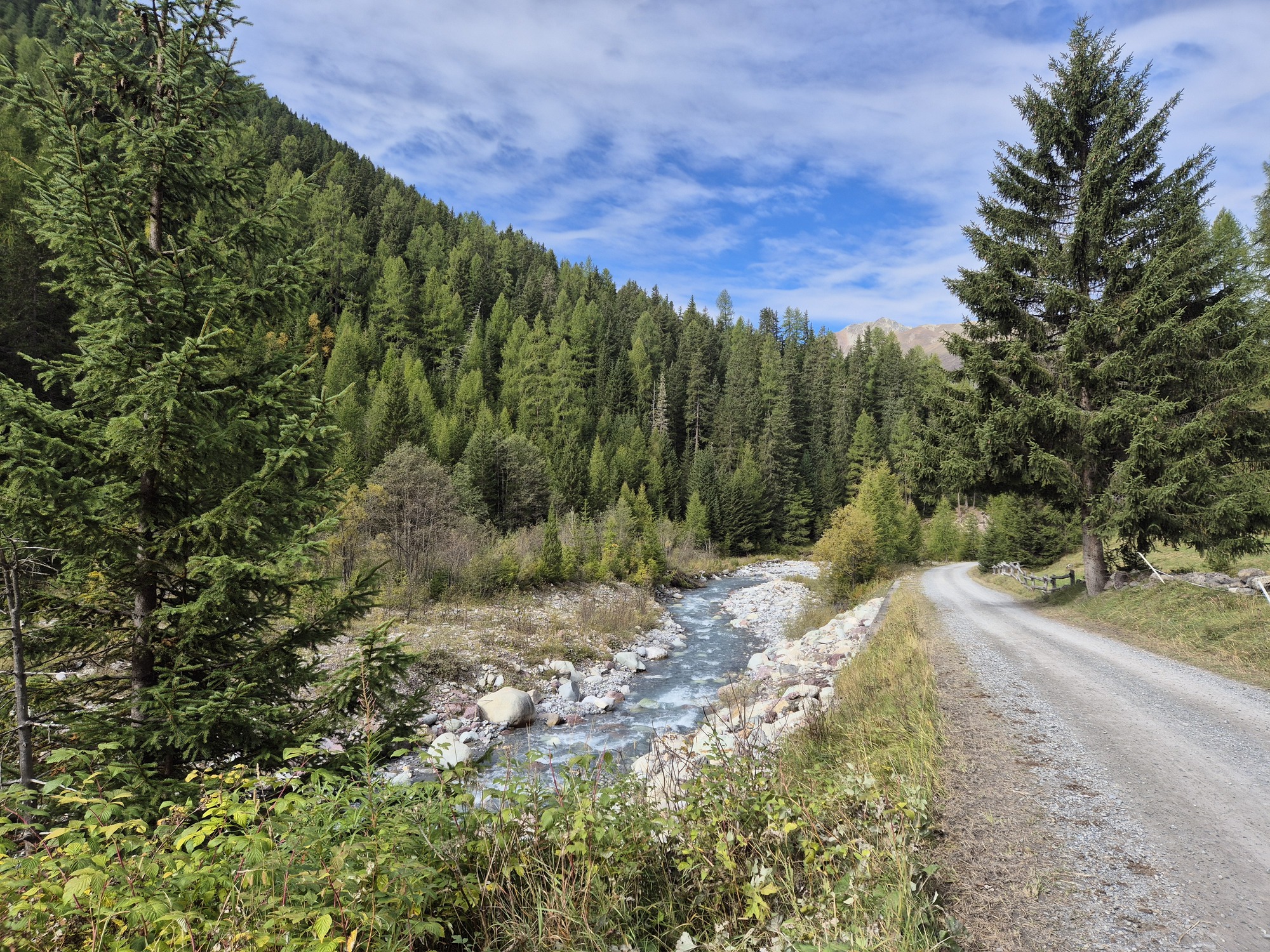
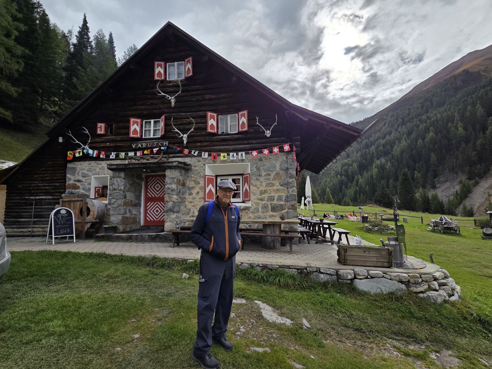

Laurel above the river in the forest; A perspective on the river with the easy-hiker road below; The easy road back; Ric at the coffee stop; The Tourist Shuttle.
Thus refreshed, we took the ultimate easy-hiker route down a road that the shuttle runs on. Many cyclists were using it to go up the valley and a fair number of walkers chose the groomed route as well.
Arriving back at the start, the 11:08 bus had left 5 minutes prior and the next one was not until 12:15. Time for an early lunch break! Does it get any better than a path to cappuccino and lunch?
Today, we hiked to a fabulous glacier view at Morteratsch. This was at >6300 feet. Color us tired!

Discover more from Girovaga
Subscribe to get the latest posts sent to your email.

Oooh, the forested mountain is really speaking to me. Spectacular! What an excellent choice for your fall adventure! Grier
LikeLike
You’d love it!
LikeLike