20 January 2025.
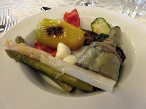
Getting home from a trip there’s a lot to do in a jet-lagged state: unpacking, laundry, restocking the pantry and refrigerator, doing the delayed fall garden chores, convincing the cats we still love them.
But the real work starts once jet lag passes: organizing photos and updating our books. This takes hours and hours to ensure the accuracy of every recommended URL, the schedules for buses and lifts, the most recent transportation pass offers, and to write up new hikes and changes to prior recommendations. Ah, retirement! But this is a job.
January 1 we published the 4th edition of “Walking in Switzerland’ Berner Oberland” and January 18, “Walking in Italy’s Val Gardena” came out in its 6th iteration.
For those dreaming about these locations, we offer inspiration to plan the trip with logistics seldom found concisely presented online. From transportation to trailheads, each walk or hike is described clearly so you can be certain every hike is within your ability.
Here’s a description of each book and a link to purchase in the US. For other markets, consult your respective Amazon site.
Walking in Italy’s Val Gardena
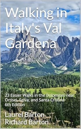
There are many hiking guides to Italy’s Dolomites featuring long treks of 4-6 hours, as well as multi-day ventures and the famous via ferrata. What makes this one so special? This is a guide to easier options for walking in Italy’s breathtaking Val Gardena! Seniors, people with children, and anyone who wants to experience the mountains but not climb them will benefit from the 23 walks that are carefully described.
We guide the hiker through the breathtaking scenery using itineraries suitable for anyone who likes to walk, likes to be in nature, and who enjoys Italy, but may not have the stamina for longer, more strenuous hikes.
This unique guide includes 23 walks in-and-near the Val Gardena towns of Ortisei, Selva, and Santa Cristina, as well information on when to visit, how to get around without a car, and sample itineraries to help you plan your stay of 3, 5, 7 or more nights. Of special interest will be the easy hikes in the amazing Alpe di Siusi.
Included are maps, directions to the trailheads, walking time and distance, where to eat along the trail, beautiful photographs, and details on how to use the system of mountain lifts and buses to access the high meadows and breathtaking Dolomite views. You will discover delightful rifugi, mountain restaurants offering shelter and great food making each walk a special expedition. In addition, every walk is accessible by public transportation!
The authors travel to Ortisei frequently exploring this mountain paradise discovering and documenting the walks to share with you so you can be certain every hike is within your ability.
Walking in Switzerland’s Berner Oberland

Switzerland’s Berner Oberland is a hiker’s paradise, whether you like easy paths or dream of attempting the Via Ferrata. This book will guide you through breathtaking scenery using itineraries suitable for anyone who likes to walk, likes to be in nature, but may not have the stamina for longer, more strenuous hikes. Seniors, people with children, and anyone who wants to experience the mountains but not climb them will benefit from the 21 walks that are carefully described. Also included are instructions on local transportation, sample itineraries to help you plan your stay of 3, 5, 7 or more nights, and suggestions for other excursions as well as rainy-day ideas.
The authors travel to Switzerland frequently exploring this mountain paradise completely via public transportation, discovering and documenting the walks. Even non-walkers will revel in the scenery as they ride mountain trains and enclosed gondola cars to amazing vistas.
What do I do after a European trip and after the book updates are published? Plan the next trip! Most likely with a cat or two in my lap.

Sven and Molly are happy to have us home.