
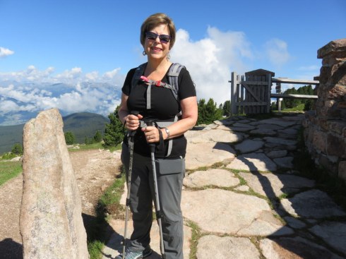
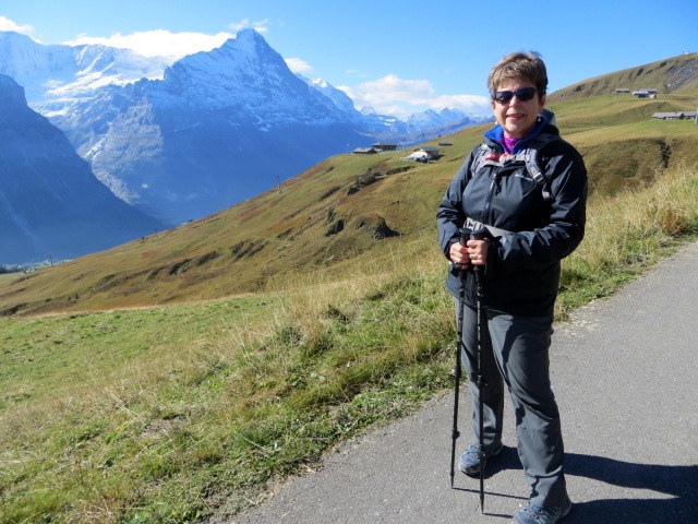
16 July 2016. We unabashedly take hikes rated as “easy” these days. Having injured both knees over the past two years, hikes labeled “moderately strenuous” are now usually just plain strenuous for us. Altitude gain doesn’t bother us too much once we are acclimated, but tough footing, disappearing trail signs, and steep descents give us cause to pause and think about how much we value our lives.
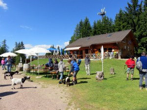
Marinzen is a lovely rifugio. Many people just ride up to hang out and not even hike.
According to the book “Walking Guide Around the Alpe di Siusi,” the hike we chose for Friday, #10 for the record, was to be an easy hike. It was depicted as a round trip that was to take 2.5 hours with 214 meters of altitude gain and loss. We are slow hikers, so we figured even if it took 3 hours, we’d be fine, and there were two rifugi where we could get lunch. Piece of proverbial cake. Ha!
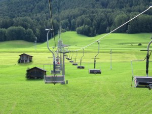
The Marinzen chairlift. Scenic, but such a cold wind this day! It goes up, up, up into the trees ahead.
The lift to our starting point at Marinzen leaves from Castelrotto at the base of the Alpe di Siusi. Marinzen is an older chairlift. Nothing wrong with it, but it is less comfy than some others in the area. It is a long ride, about 20 minutes, and this day, in JULY no less, it was cold, about 9 degrees Celsius (48 Fahrenheit) with a biting northerly wind. Brrrrr. Once we hit the trees we were shielded from the wind and the sun came out. At the top, we found a delightful refugio with baby goats only a couple of weeks old. They (the rifugio, not the goats) served great strudel, one of the best we’ve had, and a perfect cappuccino. God, I love hiking in Italy! We could have stayed awhile, but there was a hike to do.
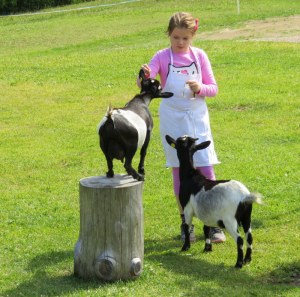
Goats being fed parsley stems at Marinzen.
The hike starts on a gravel road then veers off across a meadow with a faint track leading to a shrine. Past the shrine is a trail sign. We knew to follow #12. The path steepened so we took out the hiking sticks. It was a steady climb, but not bad, with occasional rocky sections, nothing horrible. We are, after two weeks here, acclimated to the elevation and the level of activity. Still, as we trudged on I felt it better to go forward because I really did not want to go back down that steep trail. My knees and my nerves dislike steep descents. A couple of places it was hard to discern the exact trail but we were able to look up and spot the CAI red and white sign and determine the proper path.
Looking back toward Marinzen as we set off on Trail #12. Such a promising start!
Younger people were passing us by, but we persevered. Then we came to a place where the trail might have gone straight or might have taken a left steeply uphill to a set of log steps with a railing. I was tempted to go straight, but a man was coming down from the left so it seemed a good bet that was the trail. No sign, of course. The next part was navigable, although basically a deer path with a steep drop off to the right. So glad we had our hiking sticks! Up and up we went, the drop to our right so steep that a misstep would mean waving goodbye and planning a funeral. Then we encountered an avalanche of boulders blocking the trail. It looked like a landslide from a long time ago. I wanted to turn back, but knowing how challenging the ascent had been, it made me weak in the knees to even think about it. Was there a trail that continued after the boulder field? Ric bravely scrambled up to see. Yes, he thought we could make it, so grabbing handholds on the boulders and carefully placing our feet so as to not twist an ankle or take a header over the cliff, we managed to clamber over the 40 feet of boulders blocking our way. It was not something one would expect on an “easy” hike.
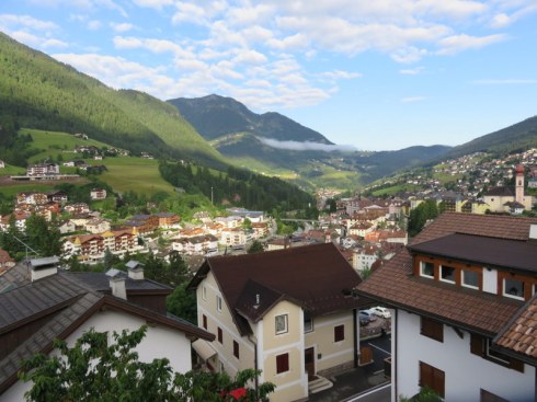
Rest stop view. By this point most of the harrowing parts were over. Looking down on the valley where Castelrotto sits.
Continuing on, now aided occasionally by some log railings to prevent a disastrous fall, at last we came to a lovely overlook with a picnic table, perfect for a rest. This was just over an hour into our supposedly 2.5-hour round trip, but we still had a long way to go. We could see the Cabinovia Alpe di Siusi and it was still a long way off. We knew our objective was past the line of the lift as it ascended. Our 1:25,000 scale hiking map showed we were past the rocky areas, but we hit one last bit of scree to navigate in an area of some water run-off then, luckily, the trail veered into the forest and the deer-path-with-a-drop-off disappeared in favor of a woody path with some rocks and roots. Relief! Eventually we joined a road and walked easily to Hotel Frommer. Walking time was about 2 hours. We are not fast, but we were moving as best we could. I think the trail is severely mislabeled at 1 hour.
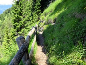
We were so concentrating on hiking that we did not take trail pictures. Oh, I wish I had a picture of the boulder field and Ric crossing it! Here, the deer path is bordered by a fence to prevent falling. Not the case everywhere along this trail
In fact, in post-hike wonderment, I went seeking more information on this trail, which was very hard to find. A source I found in Italian put this section alone at 2 hours with 400 meters of elevation change given the ups-and-downs. This is, to our point-of-view, more accurate. Ric used his altimeter app to check the altitude at several points and determined the authors just checked the altitude at Marinzen and the altitude at Frommer and did the math, not accounting for higher points along the way. Losers. Oh, and the second source rated the trail intermedio, not easy.
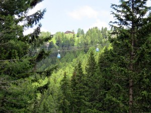
Can you see the little blue ovals? That is the cabinovia that whisks people up-and-down from the Alpe di Siusi. We are nearing the end of the hike, having passed under it.
Starving by now, our strudel long forgotten, we decided to have lunch at Hotel Frommer. But there was no one in sight. Seemed closed. Time to break out the emergency trail mix and, unbelievably, wait for a bus to rescue us. Since we are in a land where travelers and hikers are catered to with public transportation, we found while sitting at our little picnic rest area that there is a bus that stops at Hotel Frommer. Score! The next portion of the hike was to be on a different trail, and the signs indicated perhaps an hour, but based on the experience to this point, we had our doubts. We did not want to chance it. In 20 minutes a bus came along and for €8.50 per person we rode down in comfort, all the way to Castelrotto, instead of finishing the hike.
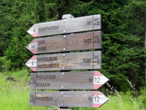
Note the sign at the bottom, 1 hour to Marinzen. We were 2+ at this point on the “easy” hike.
In a bit of a snit since we have now done three hikes from this book and two of them severely under-estimated the duration, I wrote a very thorough email to the author, who had invited feedback. Wouldn’t you know, the email bounced. I’ve tracked down the publisher in Castelrotto and forwarded our thoughts to an “info@” email address. No reply as yet.
Thank goodness we are experienced enough to weather a hike like this. Thank God we didn’t have small children along! Or a dog! Our old collie would’ve been impossible to get over the boulder field. The book has warnings about hikes not suitable for kids, but this particular trek carried no such warning. Surely things change in trail maintenance over the years, and this book is 6-years-old now, but I guarantee that boulder field has probably been there since before local hero Luis Trenker was in utero. It was not an “easy” hike.
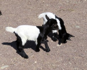
Baby goats!
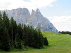
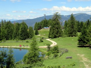
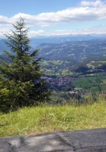
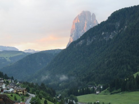
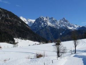
It’s all about the view and I love this one of the Sciliar and Punta Santner.


