9 October 2024.
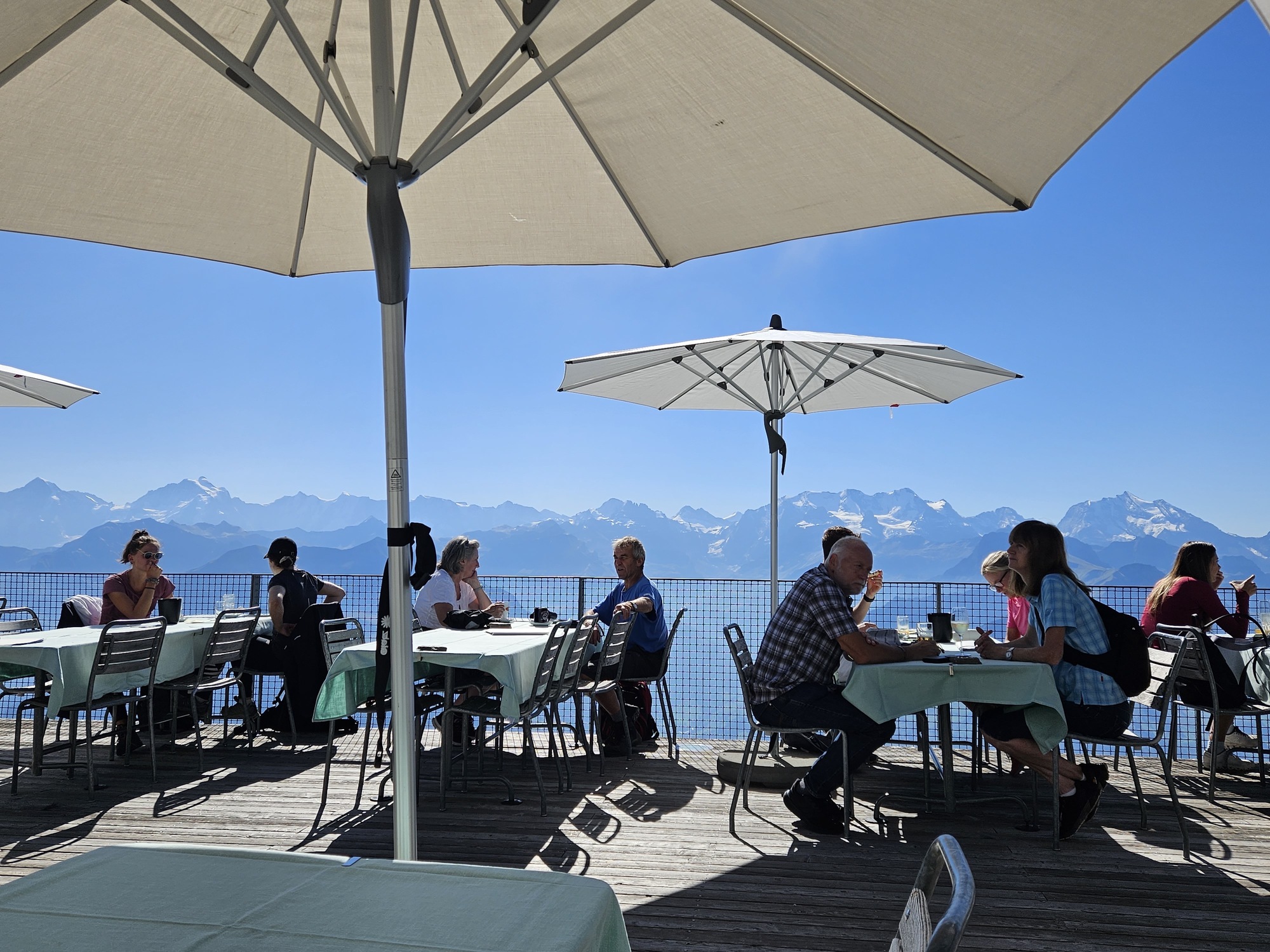
Most of you think we are on vacation, walking familiar trails, snapping pictures of stunning vistas, and sipping an aperol spritz on the deck.
Sure, we do all of that. But this is a working trip. New editions of our two books Walking in Italy’s Val Gardena and Walking in Switzerland’s Berner Oberland were released in January 2025, requiring us to check routes and supporting facts. We always try to find something new to experience and recommend as well.
We will not recommend any walk we haven’t done ourselves so we end up taking new trails often.
Sometimes a hike or walk we have included in the book no longer meets our standards. There is one in our Val Gardena book that has not been well maintained and no longer has an appeal. It will be replaced by one we have come to love.
In the past week in Switzerland, we’ve tried three supposed easy-hikes and came away with mixed results: Two unsuitable and one we are not sure is quite easy enough.
WALK ONE: Not the ending we expected
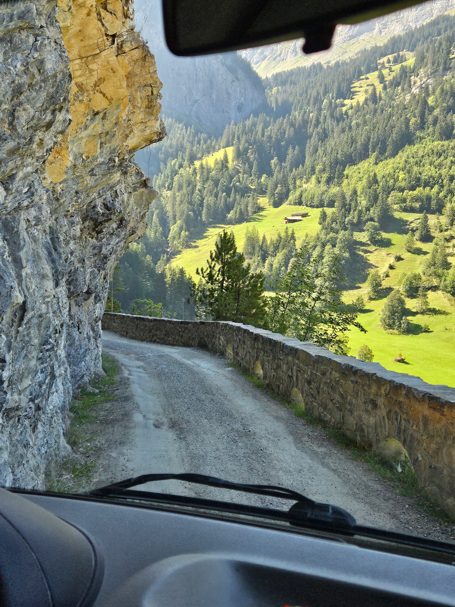
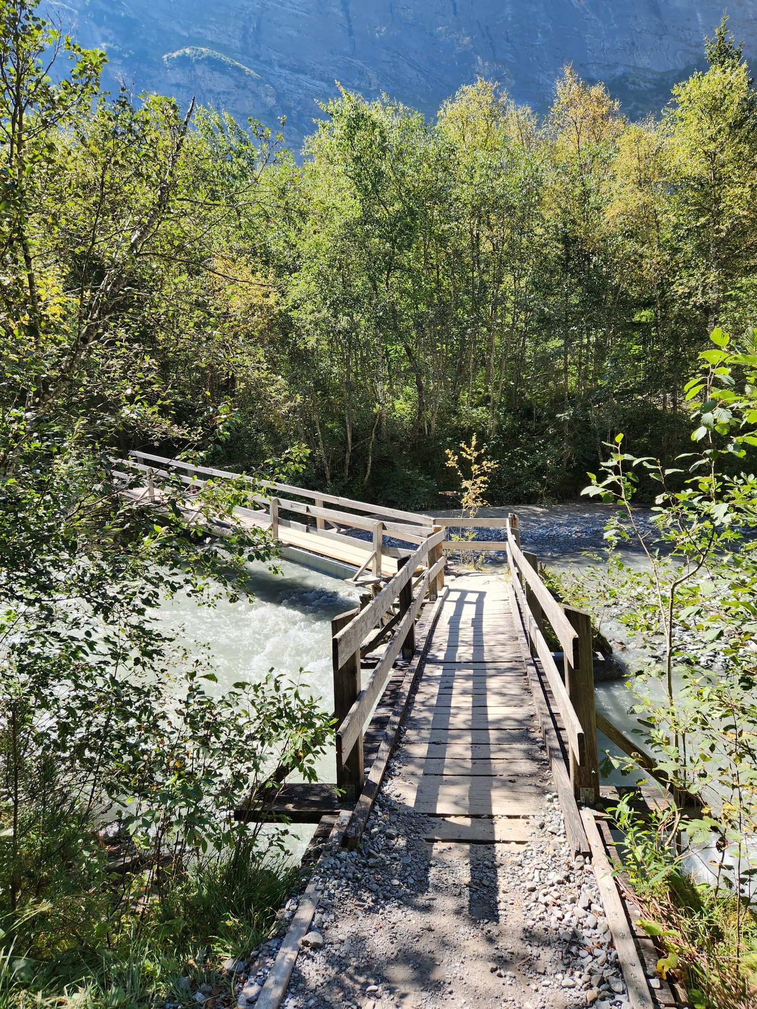
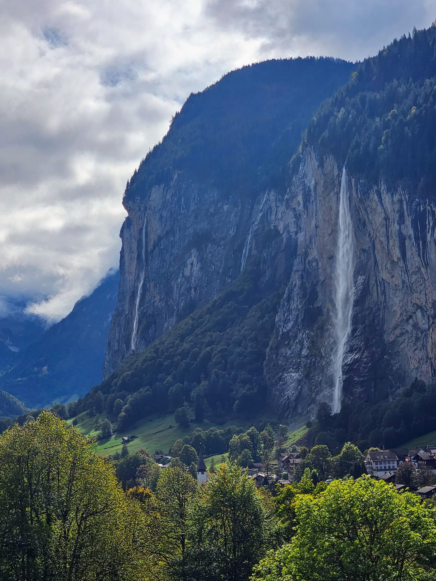
We had high hopes of recommending a Giro di Lauterbrunnen (Circuit of Lauterbrunnen) or in German, Lauterbrunnen Rundweg. For years we have noticed a trail partway up the cliff side, traversing cow-infested meadows and crossing tracks for the Wengernalpbahn train. We have walked that path from the south edge of Lauterbrunnen to the middle of the village where we descended on a paved road, but we knew it went farther. Maps enticed us to see if it would be feasible to extend it to the north, descend to the river, and walk back to the village, offering terrific views of the village from one end to the other as well as a good 3 ½ mile walk.
In fact, one CAN do this hike IF one has the footing of a steinbock.

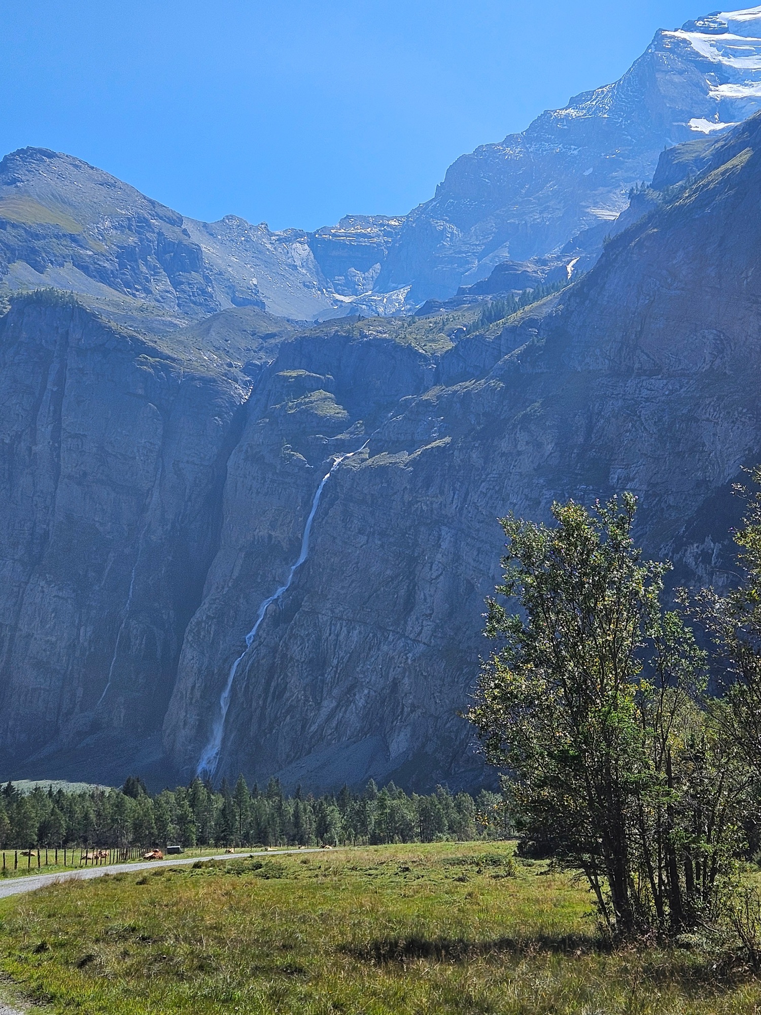
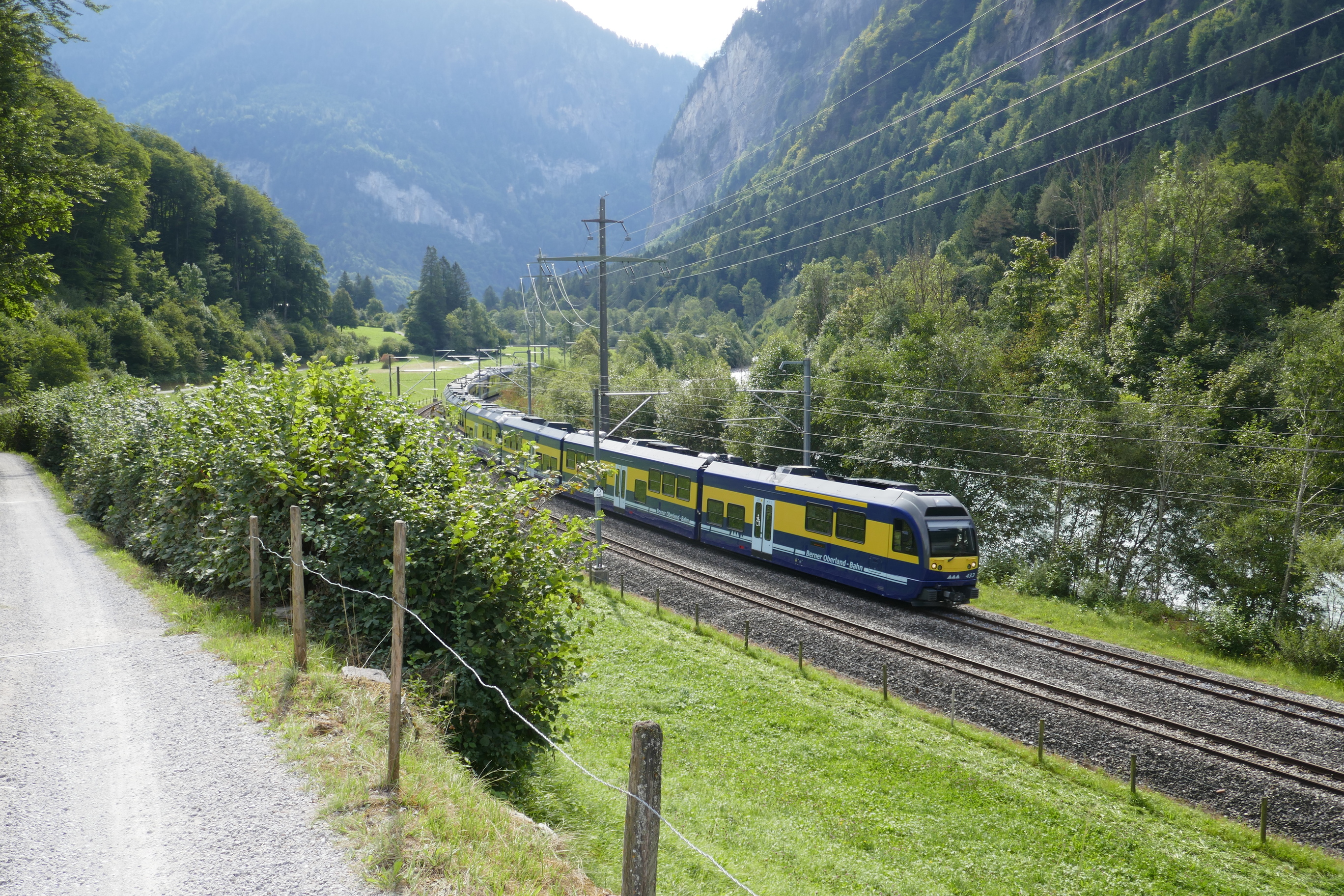
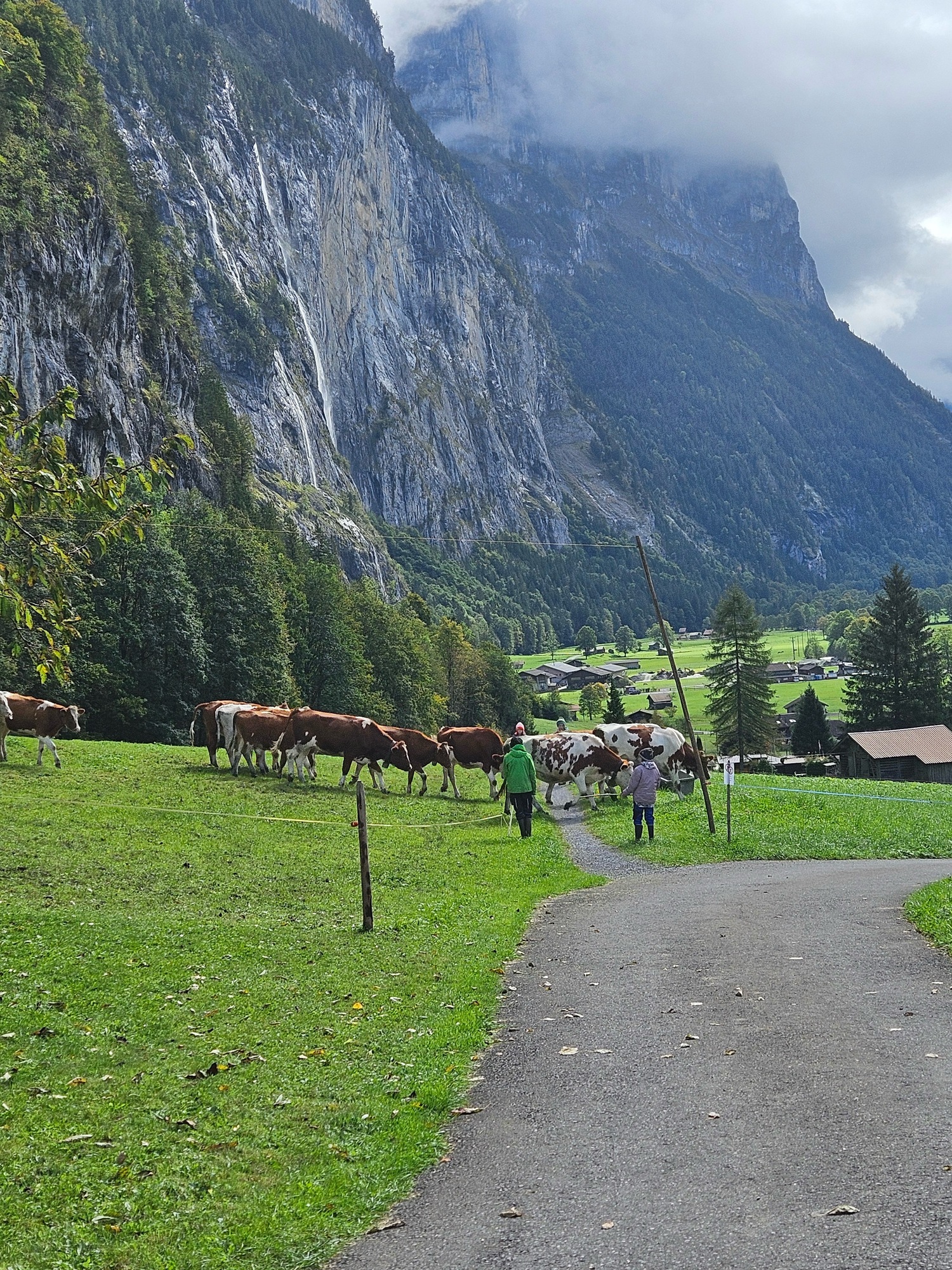
We thoroughly enjoyed the mostly flat walk, witnessing a herd of cows who welcomed their humans who had come to move them to a new pasture; taking pictures of the mountain train; wandering past a settlement of summer cabins and remote farms. The views were as we hoped including the Staubbach Falls, the train station, the Grütschalp cable car, and the entire village at our feet like a model train layout.


Then we came to the descent through the forest. Concrete forms designed to keep the farm road stable (to me, difficult to walk on) transitioned to dirt road, then, after a barrier prohibiting vehicles, a steeper, rocky downhill. As we hesitantly started down — using our hiking sticks mind you — Ric suddenly careened, fast-footing in a not-quite-controlled manner, finally stopping himself after about 30 feet by grabbing ahold of a convenient metal pole supporting a trail directional sign. I followed with terrific hesitation and concern for Ric, who much to his credit never lost his feet.
I did not think to snap a photo of the really bad area. these two pictures will give you an idea of our flat trail becoming steeper. On the left, the road starts to descend past a farm and it was fine. On the right, Ric is standing just above the final building on the farm and after that point, we rounded a corner and found a “no vehicles” barrier.


The next bit of trail was even steeper and more treacherous looking. It did not seem safe nor prudent to proceed. A 40-year-old with good knees, strong hips, and no sense of their own mortality would not hesitate to descend, but we have none of those criteria going for us, so we turned back. A broken hip would not enhance our experience. Luckily going back to the paved road into the village was under a mile.
This is a particularly local section of Lauterbrunnen: there just are not tourist lodgings on this road. Although there is one small holiday let, coming from the village the paved road leads to a retirement apartment building, local farms, and then to the route we walked.
Still, people who have no business driving here in their rental cars insist on touring the roads where they are warned not to drive. How much clearer can it be that this sign is at the entrance to the road? Can you tell it is such a problem they have to post it in multiple languages?
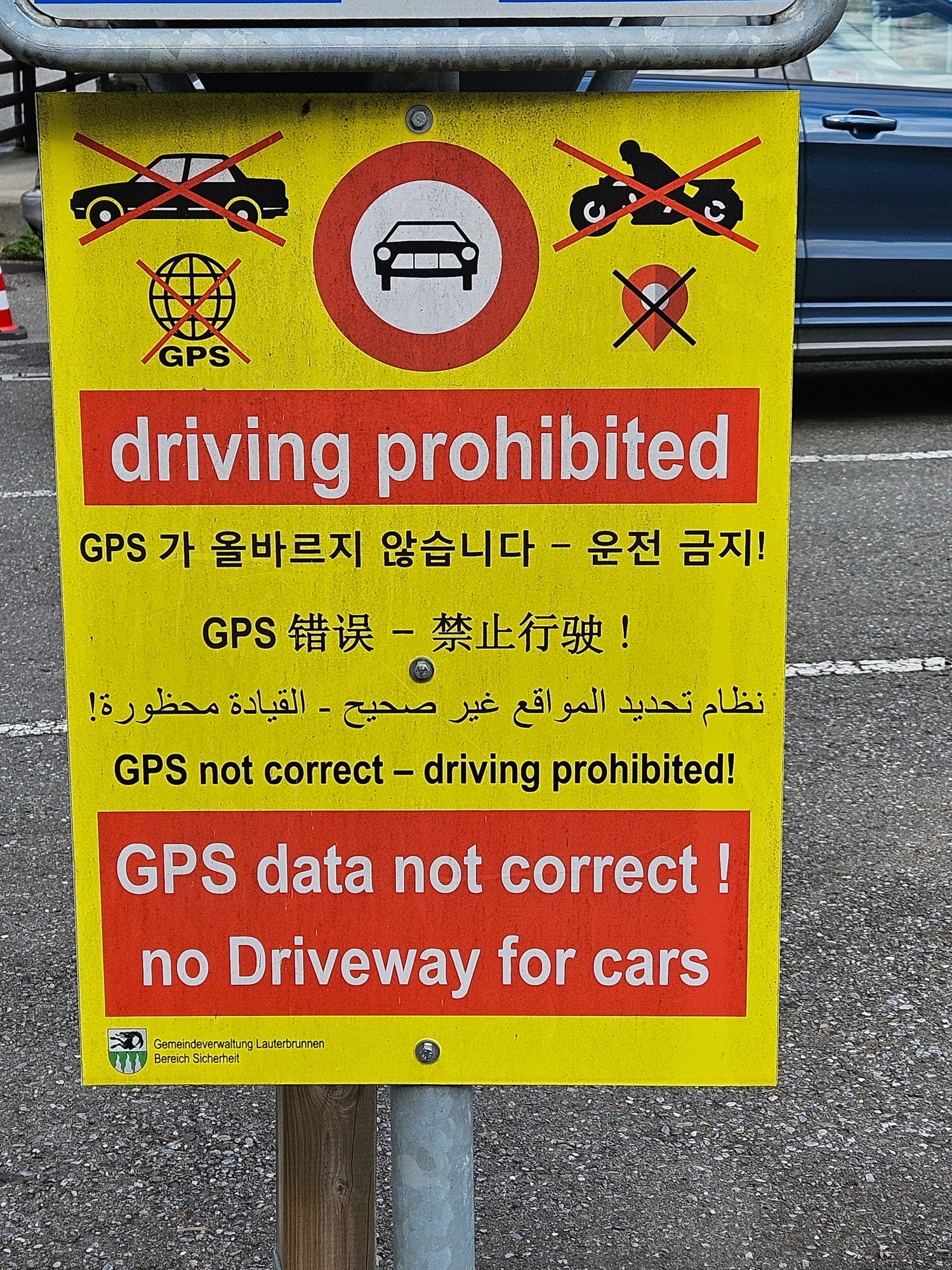
On our descent we saw three cars, one after another, come up and encounter problems. One driver tried to turn around in the patio/driveway of a local who came out and gave him a finger-wagging dressing-down. Immediately behind this confused lad, three guys in a BMW stopped, realized they were blocked, tried to turn into a lane not much wider than a footpath, and banged into a raised sewer cover. Ouch! Hope they had insurance! Hot on their tail was another pair of guys who at least had the good graces to look abashed at having driven into the forbidden area.
Last year some yokel tried to drive up to the car-free town of Wengen and got stuck on the trail. They had to be airlifted out by a helicopter. Can you imagine how excited their car rental agency was?
Our search for a circular walk of Lauterbrunnen did not work out but the ending was quite entertaining. I feel sorry for the locals who deal with this day-in-and-day-out, though.
WALK TWO: Too dull to finish
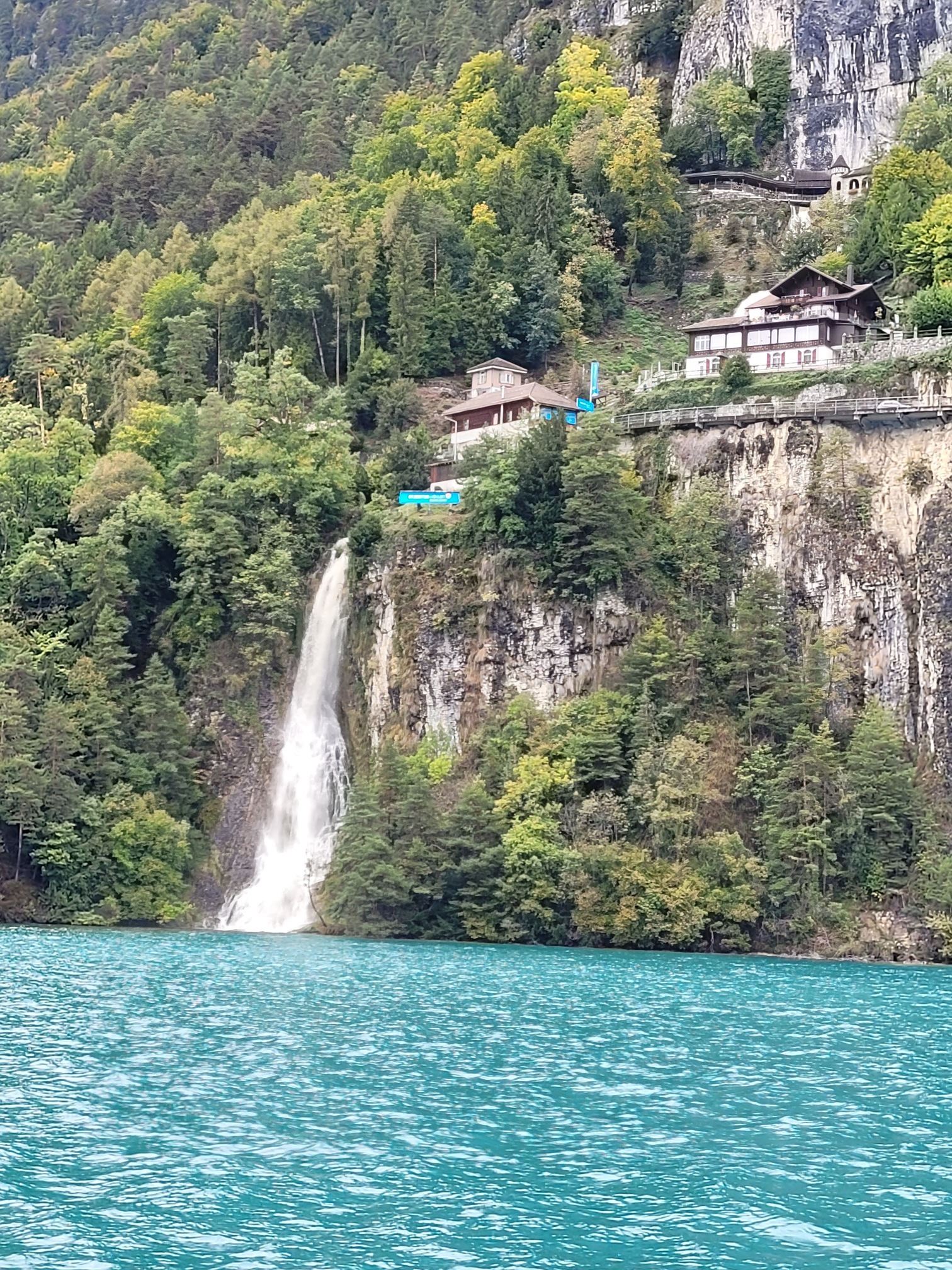
We have spent precious little time on Lake Brienz: we have one lovely lakeside walk in our book, from the tiny village of Iseltwald to Giessbach Falls. We endeavored to find a route on the south shore of the lake, close to Interlaken but away from the tourist hoards. Sad to say, our walk at Ringgenburg while definitely off-the-beaten and offering nice lake views, was so dull we stopped halfway through and caught a bus back.
WALK THREE: Good potential
A couple of years ago a local resident of Thun told me about a loop route at Aeschi bei Spiez, above the lake town of Spiez, about an hour from Lauterbrunnen. The Aeschi Bänkli Rundweg takes in the cow-studded meadows above Spiez, distant peaks, and stunning views of Lake Thun. At 4+ miles it seemed doable — and we did it — but has some downsides that have us hesitant to recommend it. One half is largely paved roads where you can walk abreast. The other half is not paved and consists in part of faint paths across grass and some other very narrow paths. We had to do a bit of way-finding to decipher the best route and made a couple of misjudgments. Can’t have that in a book so we’d have to re-walk the route to get a good fix on foolproof directions.


One half of the hike is relentlessly up-up-up and the other a constant descent. There is little undulation nor flat walking. The ascent was gentle but still, two miles of constant uphill for a total of 568 feet; the descent was not steep but needed constant attention. While relatively easy, this walk might be a Category 2 or 3 walk in our book, but we certainly cannot recommend it as pram worthy (Category 1), and I would hesitate to take small children as there were several sections of very narrow paths bordered by electrified pasture wires. What could go wrong?
Pluses: truly quiet, uncrowded, locals only. No sign of the usual tourist throngs who flock to the waterfalls of Lauterbrunnen and the higher mountain vistas. There were many cows, a llama and alpaca farm, a small ranch, and the possibility of a meal along the way: except on Mondays when those restaurants take their rühe tag. (We were there on a Monday, the “rest day.” We ended up with grocery store sandwiches in the village. No Aperol Spritz.)
We are unlikely to include this one in the book, but I am always amazed by the Swiss ability to create walking routes centered on even the smallest villages. They are mostly well-signed, interconnected, and not only recreational but often a route easily incorporated in a day’s errands. There is a national network of barrier-free trails as well, meaning everyone can enjoy the outdoors right from a train station.
I guess if you grow up walking through pastures, you think nothing of narrowly skirting an electric fence.
Now back to my Aperol Spritz while you watch this video of the Wengernalpbahn that crossed our path Walk 1 above.