Getting home from a trip there’s a lot to do in a jet-lagged state: unpacking, laundry, restocking the pantry and refrigerator, doing the delayed fall garden chores, convincing the cats we still love them.
But the real work starts once jet lag passes: organizing photos and updating our books. This takes hours and hours to ensure the accuracy of every recommended URL, the schedules for buses and lifts, the most recent transportation pass offers, and to write up new hikes and changes to prior recommendations. Ah, retirement! But this is a job.
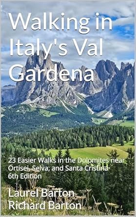
January 1 we published the 4th edition of “Walking in Switzerland’ Berner Oberland” and January 18, “Walking in Italy’s Val Gardena” came out in its 6th iteration.
For those dreaming about these locations, we offer inspiration to plan the trip with logistics seldom found concisely presented online. From transportation to trailheads, each walk or hike is described clearly so you can be certain every hike is within your ability.
Here’s a description of each book and a link to purchase in the US. For other markets, consult your respective Amazon site.
There are many hiking guides to Italy’s Dolomites featuring long treks of 4-6 hours, as well as multi-day ventures and the famous via ferrata. What makes this one so special? This is a guide to easier options for walking in Italy’s breathtaking Val Gardena! Seniors, people with children, and anyone who wants to experience the mountains but not climb them will benefit from the 23 walks that are carefully described.
We guide the hiker through the breathtaking scenery using itineraries suitable for anyone who likes to walk, likes to be in nature, and who enjoys Italy, but may not have the stamina for longer, more strenuous hikes.
This unique guide includes 23 walks in-and-near the Val Gardena towns of Ortisei, Selva, and Santa Cristina, as well information on when to visit, how to get around without a car, and sample itineraries to help you plan your stay of 3, 5, 7 or more nights. Of special interest will be the easy hikes in the amazing Alpe di Siusi.
Included are maps, directions to the trailheads, walking time and distance, where to eat along the trail, beautiful photographs, and details on how to use the system of mountain lifts and buses to access the high meadows and breathtaking Dolomite views. You will discover delightful rifugi, mountain restaurants offering shelter and great food making each walk a special expedition. In addition, every walk is accessible by public transportation!
The authors travel to Ortisei frequently exploring this mountain paradise discovering and documenting the walks to share with you so you can be certain every hike is within your ability.
Switzerland’s Berner Oberland is a hiker’s paradise, whether you like easy paths or dream of attempting the Via Ferrata. This book will guide you through breathtaking scenery using itineraries suitable for anyone who likes to walk, likes to be in nature, but may not have the stamina for longer, more strenuous hikes. Seniors, people with children, and anyone who wants to experience the mountains but not climb them will benefit from the 21 walks that are carefully described. Also included are instructions on local transportation, sample itineraries to help you plan your stay of 3, 5, 7 or more nights, and suggestions for other excursions as well as rainy-day ideas.
The authors travel to Switzerland frequently exploring this mountain paradise completely via public transportation, discovering and documenting the walks. Even non-walkers will revel in the scenery as they ride mountain trains and enclosed gondola cars to amazing vistas.
What do I do after a European trip and after the book updates are published? Plan the next trip! Most likely with a cat or two in my lap.
Most of you think we are on vacation, walking familiar trails, snapping pictures of stunning vistas, and sipping an aperol spritz on the deck.
Sure, we do all of that. But this is a working trip. New editions of our two books Walking in Italy’s Val Gardenaand Walking in Switzerland’s Berner Oberland were released in January 2025, requiring us to check routes and supporting facts. We always try to find something new to experience and recommend as well.
We will not recommend any walk we haven’t done ourselves so we end up taking new trails often.
Sometimes a hike or walk we have included in the book no longer meets our standards. There is one in our Val Gardena book that has not been well maintained and no longer has an appeal. It will be replaced by one we have come to love.
In the past week in Switzerland, we’ve tried three supposed easy-hikes and came away with mixed results: Two unsuitable and one we are not sure is quite easy enough.
WALK ONE: Not the ending we expected
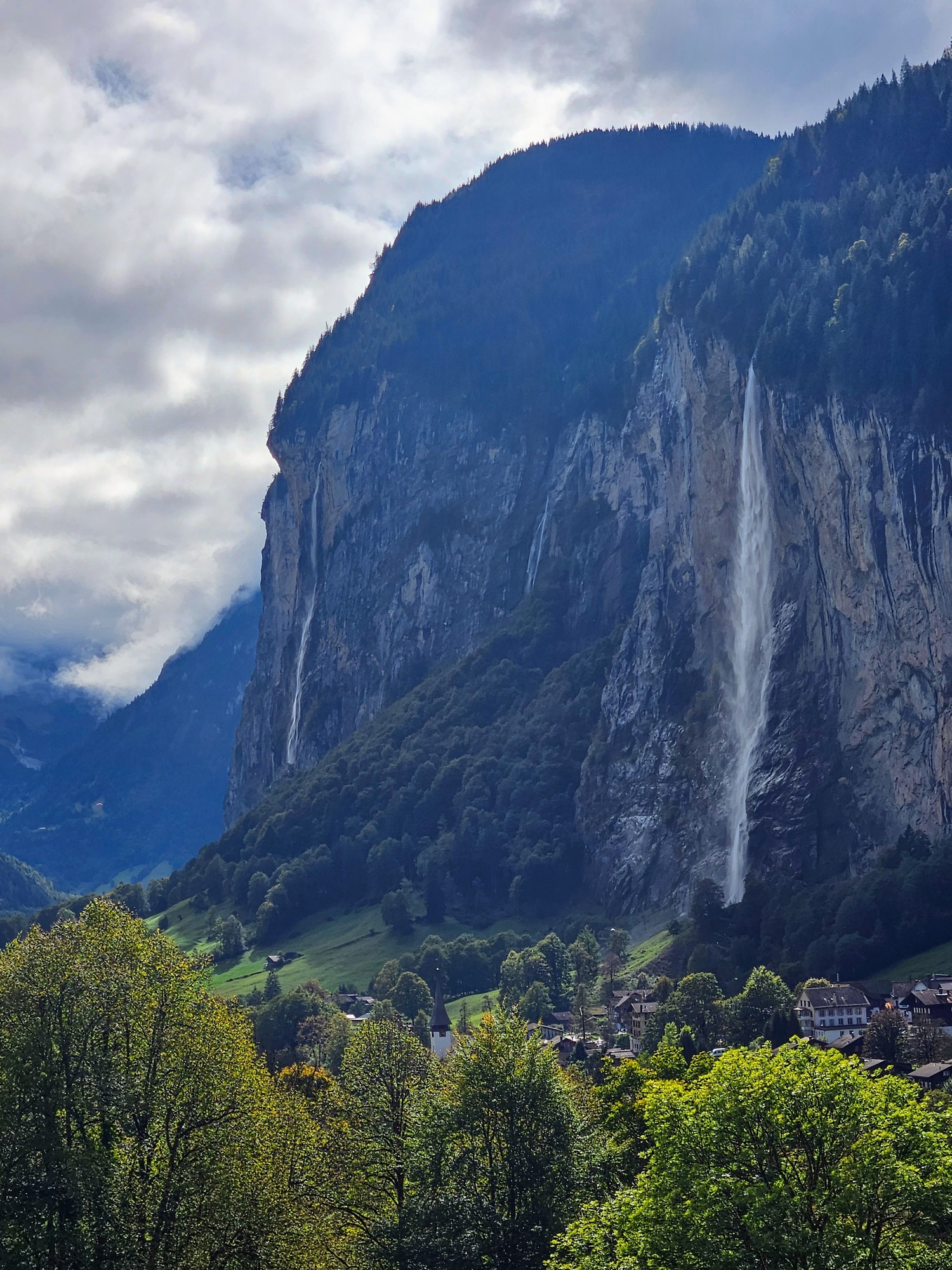
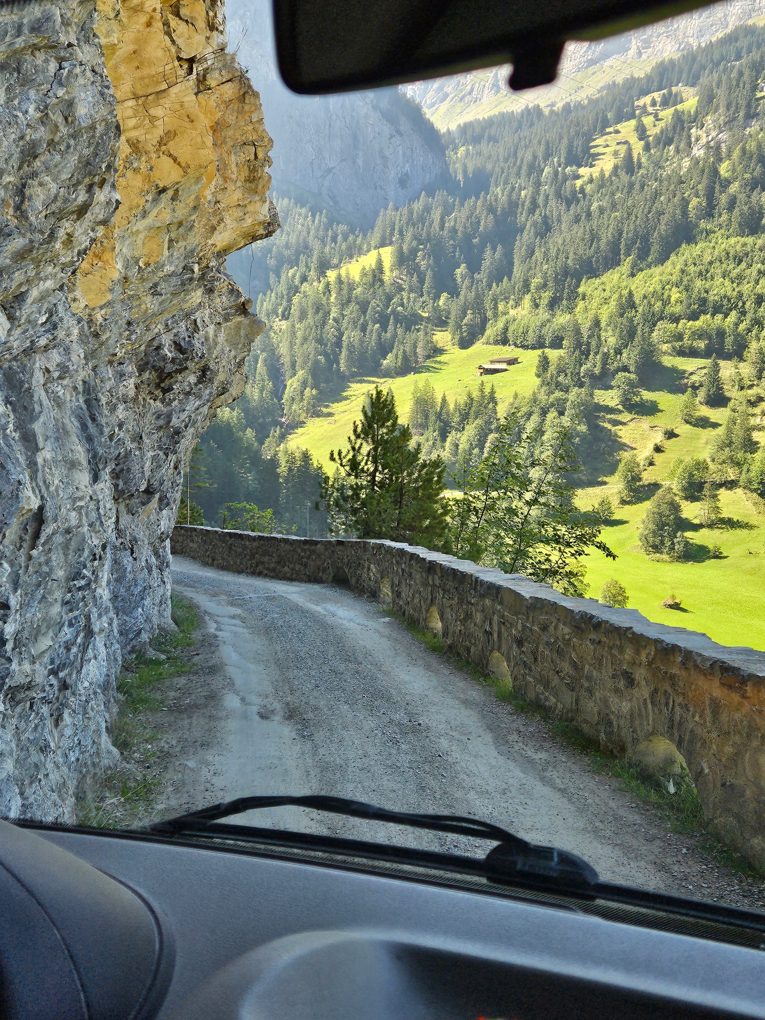
We had high hopes of recommending a Giro di Lauterbrunnen (Circuit of Lauterbrunnen) or in German, Lauterbrunnen Rundweg. For years we have noticed a trail partway up the cliff side, traversing cow-infested meadows and crossing tracks for the Wengernalpbahn train. We have walked that path from the south edge of Lauterbrunnen to the middle of the village where we descended on a paved road, but we knew it went farther. Maps enticed us to see if it would be feasible to extend it to the north, descend to the river, and walk back to the village, offering terrific views of the village from one end to the other as well as a good 3 ½ mile walk.
In fact, one CAN do this hike IF one has the footing of a steinbock.
SteinbockorIbexfamily, verysure–footed. Courtesy of IamExpat.
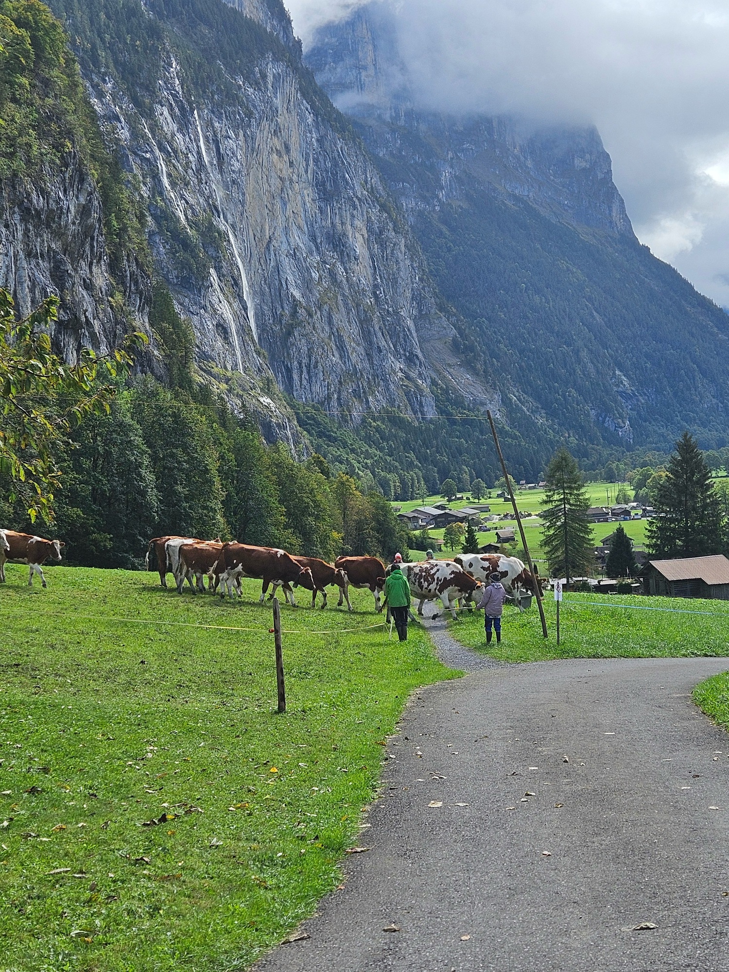
We thoroughly enjoyed the mostly flat walk, witnessing a herd of cows who welcomed their humans who had come to move them to a new pasture; taking pictures of the mountain train; wandering past a settlement of summer cabins and remote farms. The views were as we hoped including the Staubbach Falls, the train station, the Grütschalp cable car, and the entire village at our feet like a model train layout.
Bubbling streamA gentle pathDramatic viewsCows are moved from one pasture to another to do the mowing.View of the cable car across the valley
Then we came to the descent through the forest. Concrete forms designed to keep the farm road stable (to me, difficult to walk on) transitioned to dirt road, then, after a barrier prohibiting vehicles, a steeper, rocky downhill. As we hesitantly started down — using our hiking sticks mind you — Ric suddenly careened, fast-footing in a not-quite-controlled manner, finally stopping himself after about 30 feet by grabbing ahold of a convenient metal pole supporting a trail directional sign. I followed with terrific hesitation and concern for Ric, who much to his credit never lost his feet.
I did not think to snap a photo of the really bad area. these two pictures will give you an idea of our flat trail becoming steeper. On the left, the road starts to descend past a farm and it was fine. On the right, Ric is standing just above the final building on the farm and after that point, we rounded a corner and found a “no vehicles” barrier.
Here’s where it started to get steepRic, about 100 meters above our bail-out
The next bit of trail was even steeper and more treacherous looking. It did not seem safe nor prudent to proceed. A 40-year-old with good knees, strong hips, and no sense of their own mortality would not hesitate to descend, but we have none of those criteria going for us, so we turned back. A broken hip would not enhance our experience. Luckily going back to the paved road into the village was under a mile.
This is a particularly local section of Lauterbrunnen: there just are not tourist lodgings on this road. Although there is one small holiday let, coming from the village the paved road leads to a retirement apartment building, local farms, and then to the route we walked.
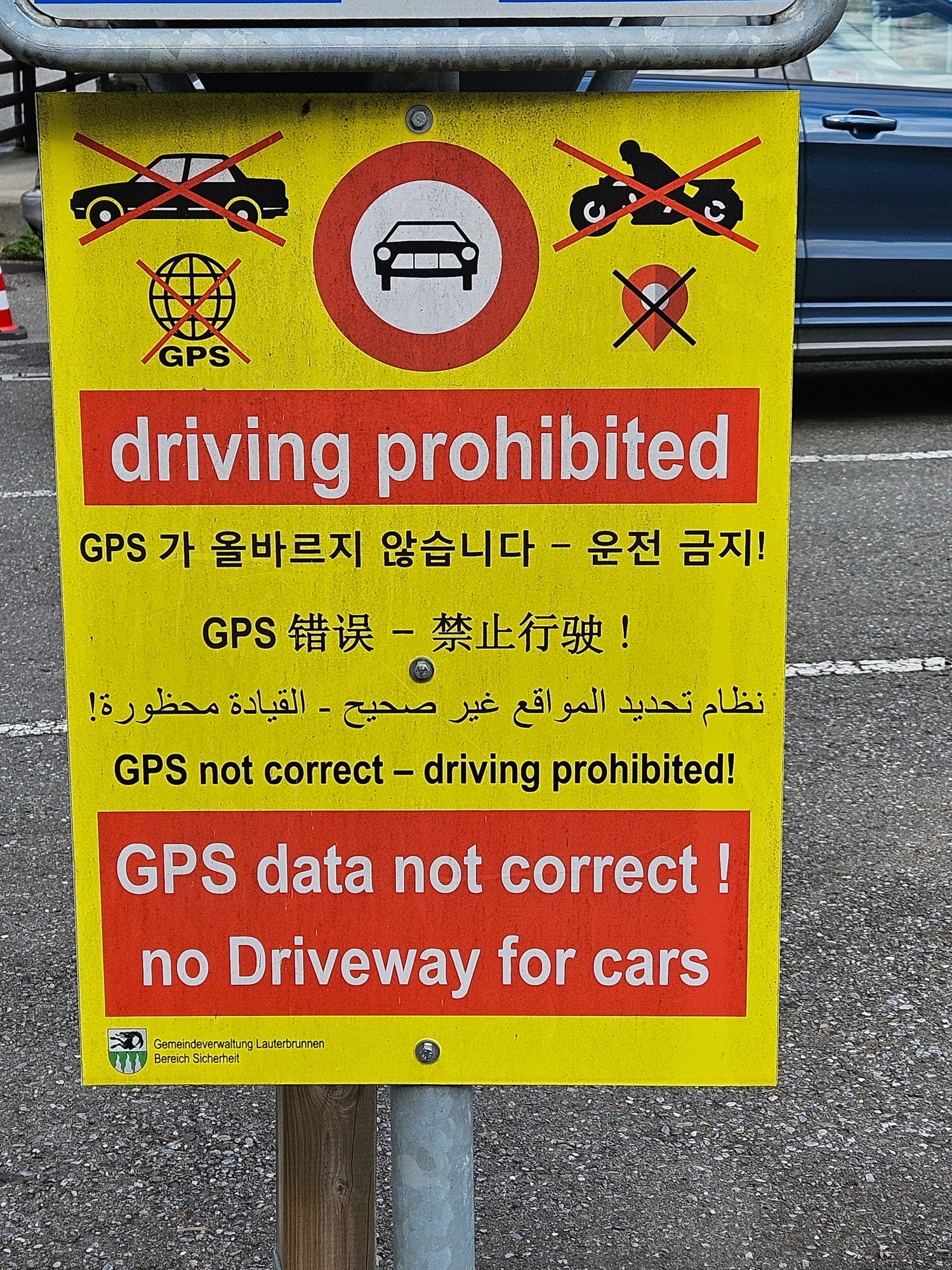
Still, people who have no business driving here in their rental cars insist on touring the roads where they are warned not to drive. How much clearer can it be that this sign is at the entrance to the road? Can you tell it is such a problem they have to post it in multiple languages?
On our descent we saw three cars, one after another, come up and encounter problems. One driver tried to turn around in the patio/driveway of a local who came out and gave him a finger-wagging dressing-down. Immediately behind this confused lad, three guys in a BMW stopped, realized they were blocked, tried to turn into a lane not much wider than a footpath, and banged into a raised sewer cover. Ouch! Hope they had insurance! Hot on their tail was another pair of guys who at least had the good graces to look abashed at having driven into the forbidden area.
Last year some yokel tried to drive up to the car-free town of Wengen and got stuck on the trail. They had to be airlifted out by a helicopter. Can you imagine how excited their car rental agency was?
Our search for a circular walk of Lauterbrunnen did not work out but the ending was quite entertaining. I feel sorry for the locals who deal with this day-in-and-day-out, though.
WALK TWO: Too dull to finish
We have spent precious little time on Lake Brienz: we have one lovely lakeside walk in our book, from the tiny village of Iseltwald to Giessbach Falls. We endeavored to find a route on the south shore of the lake, close to Interlaken but away from the tourist hoards. Sad to say, our walk at Ringgenburg while definitely off-the-beaten and offering nice lake views, was so dull we stopped halfway through and caught a bus back.
WALK THREE: Good potential
A couple of years ago a local resident of Thun told me about a loop route at Aeschi bei Spiez, above the lake town of Spiez, about an hour from Lauterbrunnen. The Aeschi Bänkli Rundweg takes in the cow-studded meadows above Spiez, distant peaks, and stunning views of Lake Thun. At 4+ miles it seemed doable — and we did it — but has some downsides that have us hesitant to recommend it. One half is largely paved roads where you can walk abreast. The other half is not paved and consists in part of faint paths across grass and some other very narrow paths. We had to do a bit of way-finding to decipher the best route and made a couple of misjudgments. Can’t have that in a book so we’d have to re-walk the route to get a good fix on foolproof directions.
Cow-studded meadowsGood signs overallNarrow path between electric wires on pasturesStunning geology
One half of the hike is relentlessly up-up-up and the other a constant descent. There is little undulation nor flat walking. The ascent was gentle but still, two miles of constant uphill for a total of 568 feet; the descent was not steep but needed constant attention. While relatively easy, this walk might be a Category 2 or 3 walk in our book, but we certainly cannot recommend it as pram worthy (Category 1), and I would hesitate to take small children as there were several sections of very narrow paths bordered by electrified pasture wires. What could go wrong?
Pluses: truly quiet, uncrowded, locals only. No sign of the usual tourist throngs who flock to the waterfalls of Lauterbrunnen and the higher mountain vistas. There were many cows, a llama and alpaca farm, a small ranch, and the possibility of a meal along the way: except on Mondays when those restaurants take their rühe tag. (We were there on a Monday, the “rest day.” We ended up with grocery store sandwiches in the village. No Aperol Spritz.)
We are unlikely to include this one in the book, but I am always amazed by the Swiss ability to create walking routes centered on even the smallest villages. They are mostly well-signed, interconnected, and not only recreational but often a route easily incorporated in a day’s errands. There is a national network of barrier-free trails as well, meaning everyone can enjoy the outdoors right from a train station.
I guess if you grow up walking through pastures, you think nothing of narrowly skirting an electric fence.
Now back to my Aperol Spritz while you watch this video of the Wengernalpbahn that crossed our path Walk 1 above.
Sundays are days for long walks and special lunches, at least while we are traveling. A few years ago, I wrote about a particular favorite, which we have now done three times (See https://girovaga.com/2021/10/03/a-path-to-lunch/) with plans to repeat as often as possible.
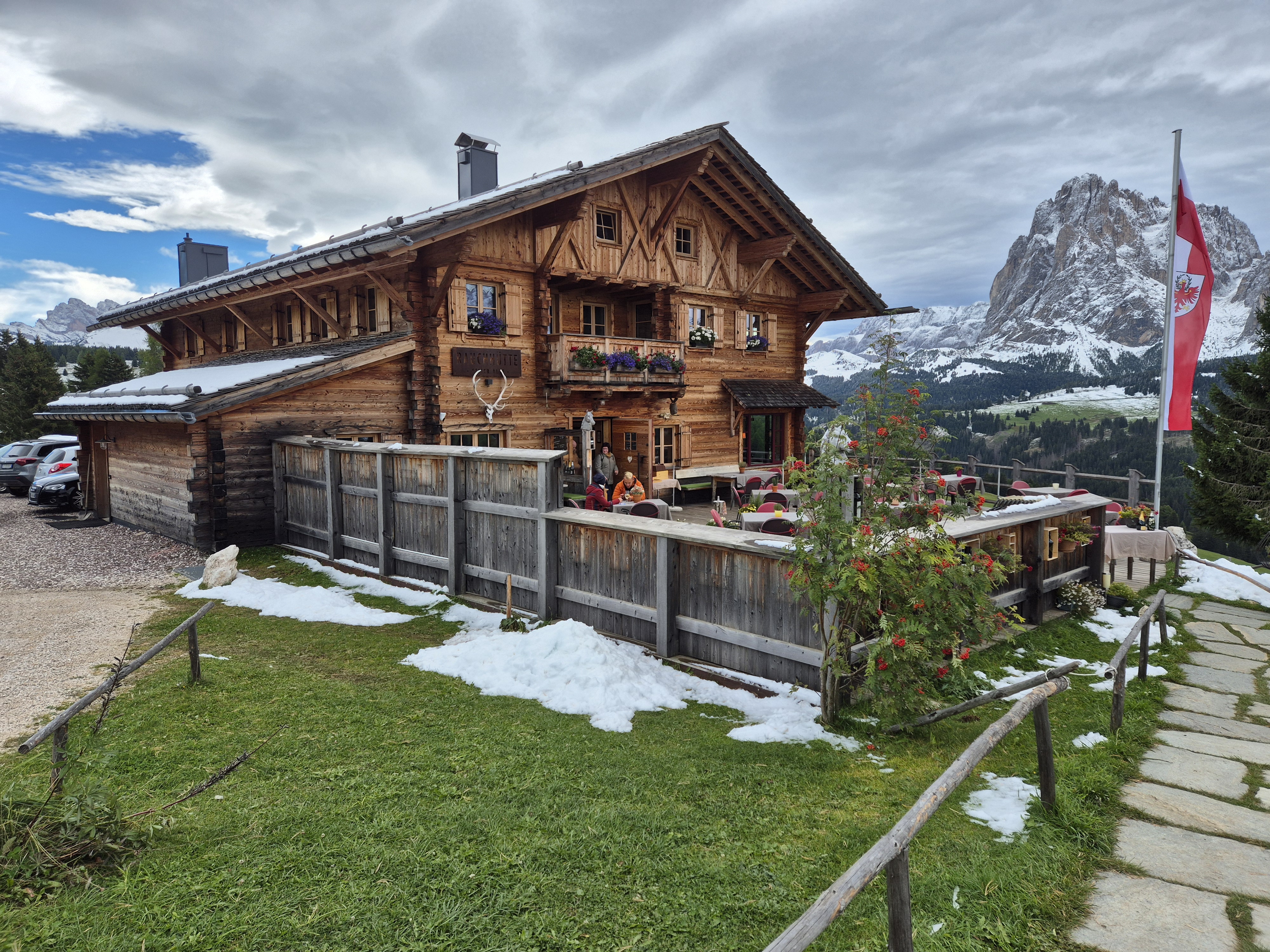
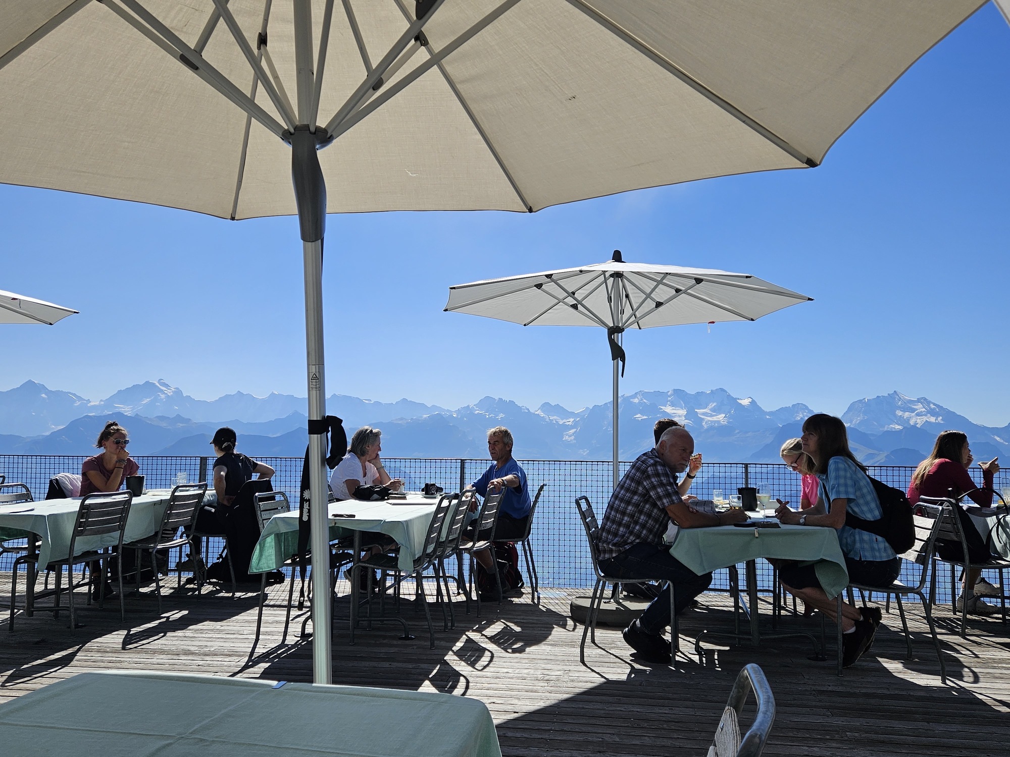
Yesterday we discovered another walk that led us to perhaps the finest mountain “hut” around, Rauchhütte on the Alpe di Siusi. I have read various raves about it: “Best hut! You have to go! Nowhere like it!” My cynical self said that all mountain huts are the same atmosphere, beverages, and mountain cuisine, in this case Südtirol specialties, beer, limited wine, grappa, and good coffee. Rauchhütte is unaltromondo: a world apart.
Perhaps I should explain the concept of today’s mountain “huts.” In Italian we call one a rifugio or baita or malga, in German it is hütte. You would probably call one heavenly. We are talking real plates, glassware, and cutlery; Espresso machines and full kitchens; Clean bathrooms. They serve simple mountain food: hearty pastas, local specialities like canederli (a kind of dumpling), cheese and meat platters, polenta, game dishes featuring boar or venison, spareribs, lots of potatoes, beer, limited wines, some hard liquor. Always strudel, homemade cakes, coffee, and so on. Hearty fare. Occasionally a salad slips into the menu.
Approaching the baita Rauchhütte.
Imagine this terrace on a sunny, temperate day!
Rauchhütte defies the traditional baita. It is a gourmet experience, a wine-driven restaurant perched in one of the most beautiful mountain settings you will find. A fabulous deck, a warm and cozy dining room, stellar service, an impressive wine list, and elevated cuisine.
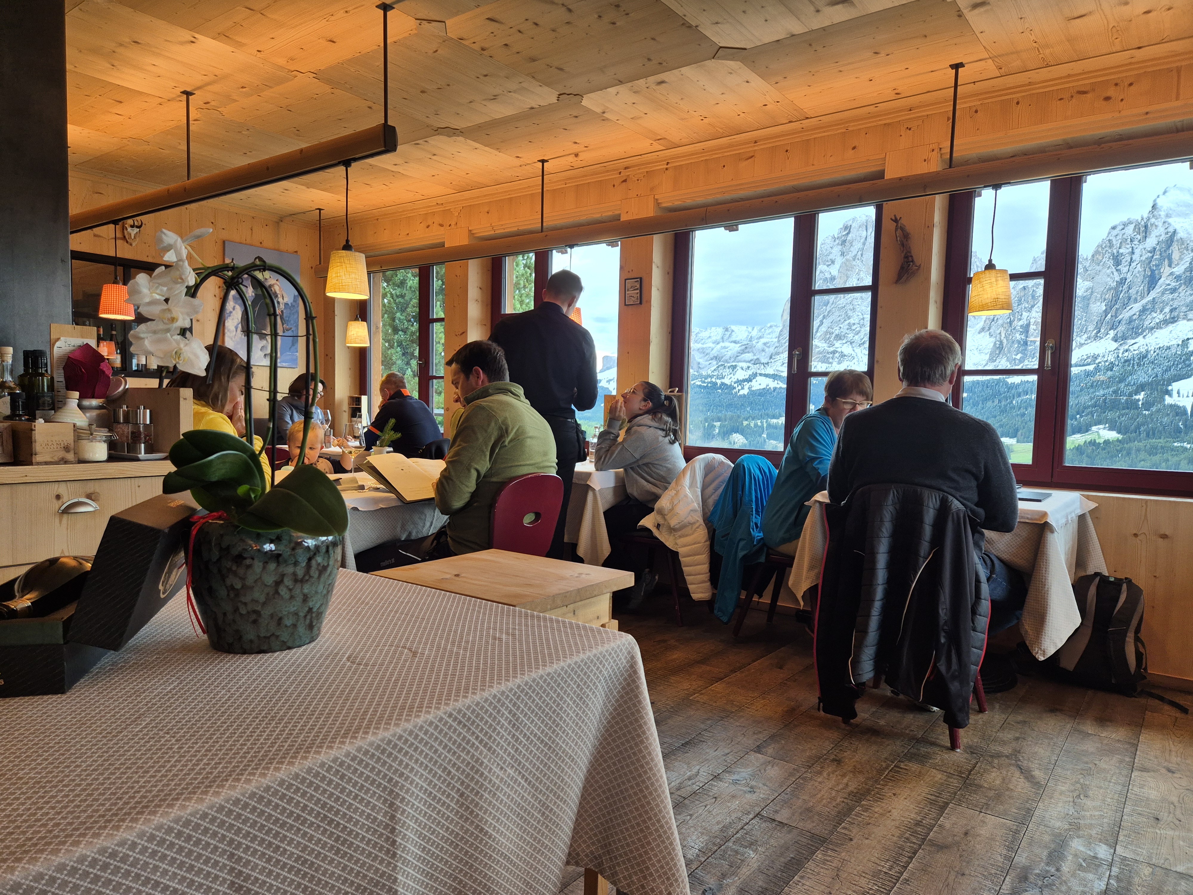
It was almost full when we arrived at noon. We were lucky to get the last unreserved table. Sunday lunch is a big deal and people target Rauchhütte for this special time.
Interior with views to the Sassolungo and Sasspiatto.
You cannot drive to Rauchhütte. You can cycle, hike, walk, or take a bus. We walked an hour to get there from AlpenHotel Panorama as well as an hour after lunch to — get this — ride a chair lift back to our home base! Who needs a bus?
Adding to the pleasure of the day, we are having a wintery September on the Alpe di Siusi. About 6 inches of snow fell Thursday into Friday, and Saturday was cursed with a bitterly cold wind. Sunday, the winds were still, and silence descended as it does with snow on the ground. Even most of the (few) people out were not talking much. Just enjoying the unusual scene. So did we. SIGH.
Lunch was divine. Fine wines by bottle or glass, a limited but excellent menu with many specials for the day featuring seasonal favorites like porcini or deer. Yes, the local specialities were present as well, but in an elevated manner, with the service you would expect in a fine-dining restaurant; except all the patrons were dressed for outdoor sports and had backpacks at their feet.
Ric’s lunch of canederli and goulash.
My choice: Housemade pappardelle with oxtail ragu.
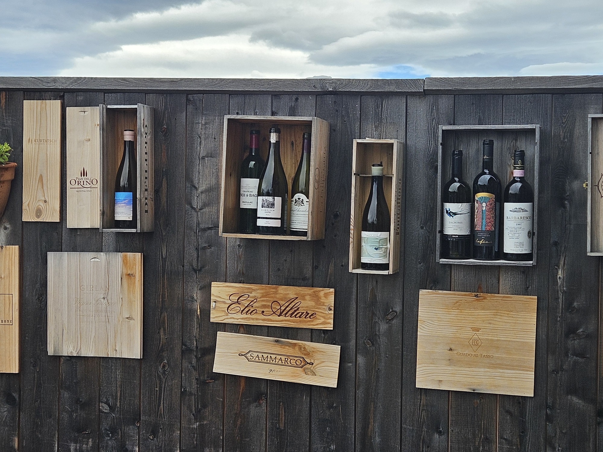
Terrace wall decorated with (empty) wine bottles. They claim to have 300 labels in the wine cellar, mostlylocal.
A total of five miles and two hours of walking might have put a dent in the house made pappardelle with oxtail rags that I snarfed down. We will be back next year. I might even include one this in the next edition of Walking in Italy’s Val Gardena.
For those who are curious about the route and know the area or are visiting, we walked Trail #6 from Panorama downhill toward Ritsch, turning right on Trail #30 until it joins the main road at the Wiedner Egg bus stop. From there, follow the road to the “hut.” The easy-hiker way back is to walk the road back to the bus stop, then follow Trail #30, the Hans and Paula Steger Trail (also in our book) all the way to Compatsch, returning up to AlpenHotel Panorama via the chairlift.
Or take the bus if you had too much wine. That might happen next year because the wine list is simply awesome.
One of the views on our path to lunch, the magnificent Sassolungo and Sassopiatto.
Not a bad pedometer count for 2-and-a-half days. I struggle to get to 10K on any given day at home.
Richmond, UK, turned out to be a perfect post-Transatlantic flight stopover between Portland and Italy. Instead of taking a second hop to the continent, with the inevitable 3-hour layover at Heathrow, we opted this year to sleep where we landed for a few nights. (Last year the haul from PDX to LRH to ZRH was exhausting.)
We knew we wanted to visit some locations in Richmond and not stay in central London. We did not know how much walking we’d manage to do. Excellent weather helped.
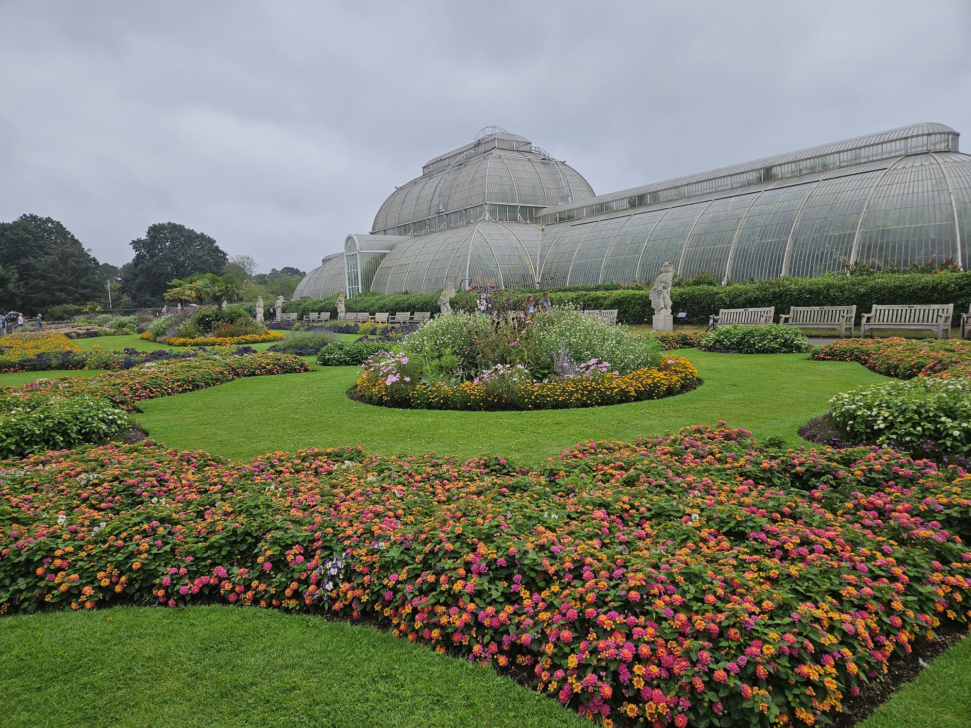
Kew Gardens is magnificent. This was our third tour there and we are still finding corners we had not explored. Kew is 330 acres of forest, groomed gardens, conservatories, a horticulture school, and research facilities. They claim status as “the largest and most diverse botanical and mycological collections in the world” according to Wikipedia. Kew (see map) is four times bigger than Bodnant Gardens, which impressed us so much in Wales last year.
This visit we discovered a few areas previously unknown to us, including a magnificent collection of rock gardens organized by geography, and the (seemingly) boring “Grass Garden” was actually a stunning display of ornamental grasses, not a field of Kentucky Bluegrass. Makes me want acreage to be able to plant in such masses. The biological diversity in these 330 acres is astounding. We have visited in spring, late fall, and now late summer. Each season is spectacular, so if you are in London, take a day away to visit charming Richmond and Kew Gardens. By train, no less.
Day two for us was to be a visit to Hampton Court Palace, one of Henry the VIII’s country homes. Sadly, a few days before we arrived, we received word that they would be closed for seasonal maintenance on the only two days we had to visit. Due to fascination with Henry VIII (thank you, Wolf Hall) we have had HCP on the list for a few years and there it shall remain. Next visit.
Top row: The 1844 Palm House; Autumn color creeping in. Second row: The Grass Garden. Third row: Rock Garden.These photos do not begin to show the extent and the beauty. Fourth row: The Broad Walk, colorful borders.
Instead, we chose to walk a section of the Thames River Path. Imagine if the major river where you live had a walking path along it the entire length of it. With few exceptions, you can walk the 180-mile length of the path from near the source of the Thames to near the mouth. For reference, the main stem of the Willamette River in my state of Oregon is 187 miles long, so you could walk from Eugene to the Columbia River.
First Mate Siren
180 miles and 10 days were not in our plans, but a perfectly lovely stretch of about 6 miles suited us and included a ferry crossing at Twickenham with Siren the first mate and coffee at a garden café, plopping us back into Richmond near Kew, just in time for lunch.
Great signage; Ferryman (Siren’s dad); wide path, at least here, much used by locals; view of Richmond; Richmond Bridge
Richmond is a wonderful place to spend a few nights recovering from overseas travel or just because. Many restaurants and pubs, highly walkable, convenient to central London via public transportation if that is in the plan.
Walkers, take note. Nothing difficult but you will get your steps in!
Lists abound: grocery lists, packing lists, wish lists, Christmas lists. I live by lists. I do not keep a bucket list, however. No grand scheme of things-to-do-before-I-can’t-remember-them.
Ric and I do, however, make note of places we’d like to return to, things we’d like to do in our favorite places, and places we might want to work into a future itinerary. This trip, we have checked off some places and things that have been on our minds for awhile. Inevitably, we’ve added some as well.
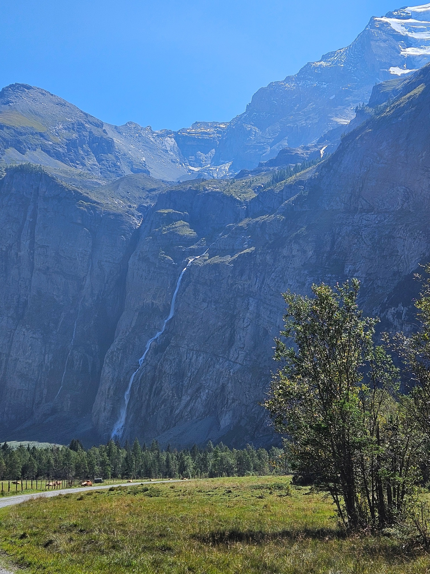
The Gasterntal has been on my list since 2021 when a fellow-traveler pointed it out as we descended from Sunnbüel. (See Another valley to discover.) Seeing the sparkling river flowing through a valley in a deep gorge, I was intrigued because it is only available a few months a year and is challenging to reach. In true Swiss fashion, there is a way to get there by public transport and one does not have to walk all the way in. Calling a few days in advance — once we knew the weather was forecast to be pleasant — I secured seats on the little shuttle bus.
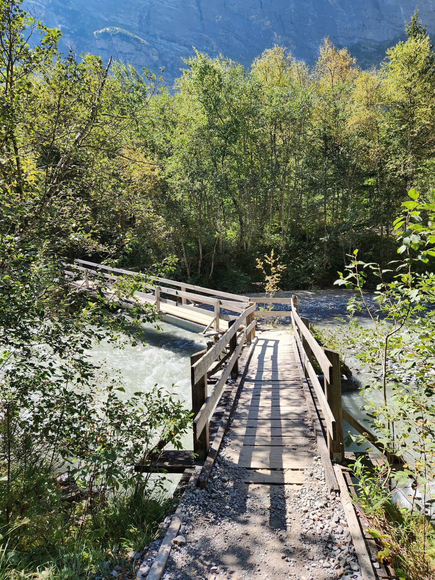
What a wild ride! Vehicles are allowed to enter the valley, by permit, only for 20 minutes each hour, and allowed to exit for a different 20 minute period each hour. The road, carved into the rock face, is truly one vehicle at-a-time. Our shuttle deposited us at Selden, the proverbial end-of-the-road. From here, the hiking was all downhill, although that is not always as easy as it sounds. This is, after all, a remote valley.
We called this Mr. Toad’s Wild Ride. From left, two views of the road carved out of the cliff. There were a couple of tunnels, too. Far right, the end of the road, at least as far as the bus would carry us. The valley goes on and experts can hike on and up and over to other valleys and towns.
One of the most amazing attributes is how few people we encountered in our two-hour hike. A handful hiking up (including people who hiked over 11 km from Kandersteg!), a few bikes where the hiking trail merged with the main road, a couple of cars that paid the day-fee for entry.
The valley is beautiful and peaceful with only the sound of the glacier fed Kander River. The rugged downhill trail has rocks and roots making for tricky footing but eventually gives way to the bottom of the glacial valley and a pleasant walk across pastureland at the end. We were welcomed by grazing cows and lively calves at the Hotel Waldhaus, a welcome site with full meal service and adult refreshments.
It is hard to show the beauty. Here are a few trail scenes.
Arriving at Hotel Waldhaus. Might be fun to spend a night here. Hearty Swiss fare for post-hike: Brautwurst is not like anything Johnsonville makes. This is served with onion gravy. We didn’t eat much for dinner.
Cross that off the list. Done and dusted! We are unlikely to repeat it, as good as it was, but I highly recommend it. If you follow our Easy-Hiker scale, this is a “4” on our scale of 1-to-3.
The challenging hike at Pontresina accomplished last week (see On the road again) was also a list item. Returning to Pontresina was a list item as well, our first visit in 2018 being inspiration for a repeat. (See Postcard from Switzerland.) In fact, this year’s visit to Pontresina has inspired us to put it on the short list for a 2024 return. There’s lots more to explore in the area and being able to speak Italian is a big draw for me.
This trip we also checked off Appenzell (lovely to visit but likely only once), Mount Niesen (no hiking but incredible views), and we are on our way to Annecy, France, which has intrigued me for a few years but has been hard to work into our annual itinerary. Eating French cuisine is a huge draw as well as the alpine environment.
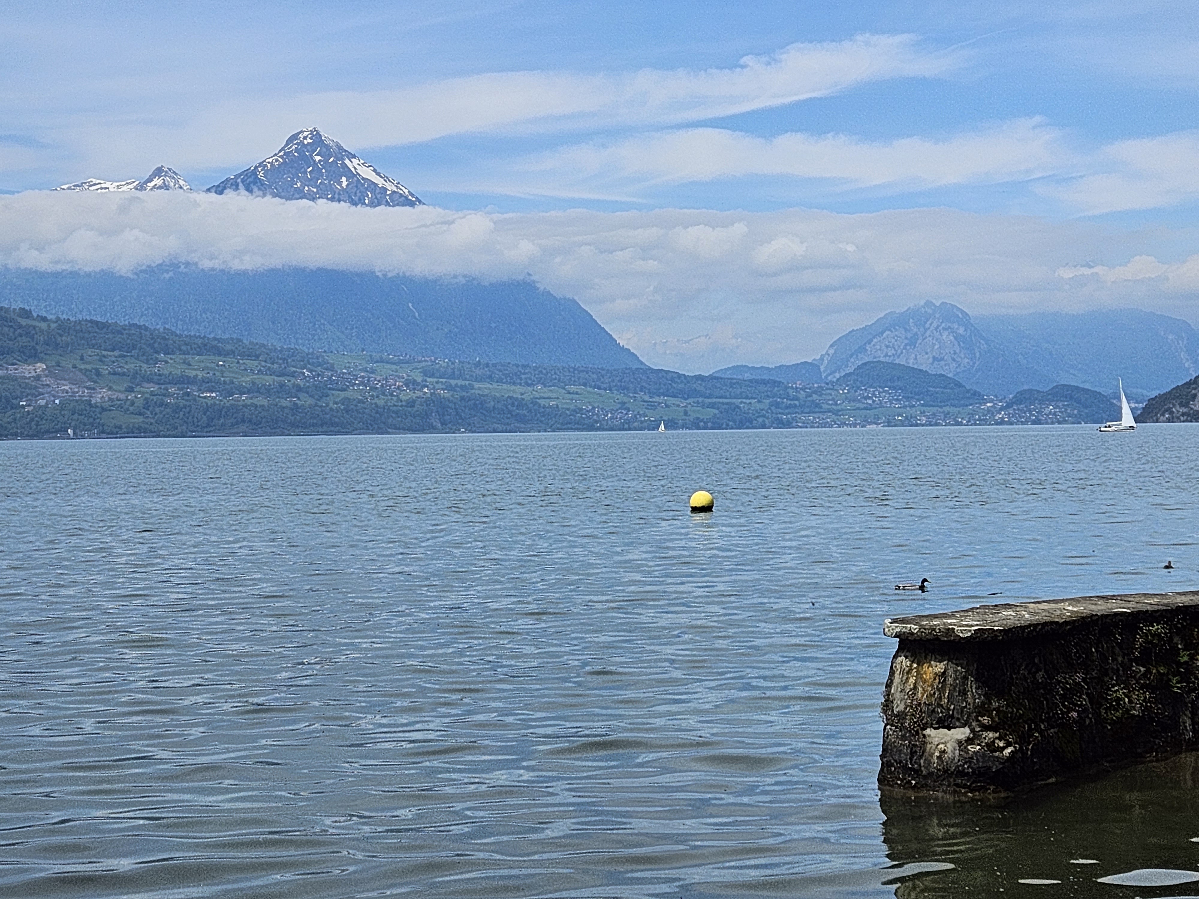
Atop the Niesen, “Switzerland’s pyramid.” From the left: The Niesen as seen from across Lake Thun near Interlaken last year; Lake Thun as seen from about 7800 feet on the Niesen; The Jungfrau Region mountains as seen from the restaurant terrace.
Still on the mental list: Hiking in Northumbria and the Isle of Wight, taking a night train between London and Edinburgh, and Midnight Trains from Paris to Venice, when it is launched.